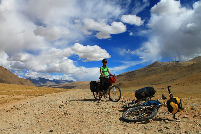
This is another route we really enjoyed cycling as the road along the Indus isn’t too busy, and from Mahe Bridge to Tso Kar there is very little traffic. The scenery in the vicinity of the Pologonka La is reminiscent of the Andean Puna – lots of high, rolling mountains and pastel colours.
| Total KM | Stage KM | Comment |
|---|---|---|
| 0 | Upshi (3,450m). Restaurants, shops, probably somewhere to stay (not that you’d want to as it’s not the nicest of places). | |
| 21 | (Leaving the main road and following the Indus up river.) Quite quiet road, pretty scenery, tarmac, not much climbing. | |
| 21 | Likche shops (3,550m). Basic supplies and possible to camp in the lovely village above the road if you ask around. | |
| 11 | Cross the Indus after 8kms, then cross back soon after. | |
| 32 | Himiya village – shops, restaurants, homestay. | |
| 58 | After 9kms pass the small village of Kyungyam Do with a building with the excellent sign: ‘All Rong Congress Committee’. 12kms later is Gayk (nothing there). 9kms later is the Kairi military post and Indus Café (3,880m). 11kms later is Nurnish village (no facilities). 6kms on to Keshar village (nice camping, but no facilities). 11kms further to Chumathang. | |
| 90 | Chumathang (4,030m) business district. Shops, restaurants, hotel (expensive). Cheaper homestays available in Chumathang village (ask at shops) 2kms along the road to Mahe. | |
| 20 | 2kms to Chumathang village, 18kms to Mahe Bridge. | |
| 110 | Mahe Bridge (4,130m). Police checkpost (one of the few places that actually looked at our Inner Line Permits). Straight on for Nyoma, Loma Bend, Hor La and Kaksang La, right for Tso Moriri, Tso Kar. | |
| 12 | (Going R). Beautiful, easy climb up valley. Still paved. | |
| 122 | Junction (4,380m) just before Puga Sumdo. Big village, saw no facilities though. L for Tso Moriri (with all the traffic, though this isn’t much), R (with 1 vehicle an hour) for Tso Kar. | |
| 21 | (Going R). 7kms to Puga village (scruffy place with no facilities). Tarmac ends 3kms after town, then it’s 11kms to the pass. Easy gradients, sometimes bumpy. Water available until a few kms after Puga village, none higher up. Plenty of places to camp. | |
| 143 | Pologongka La (4,972m). Beautiful pass that reminded us of the Andean Puna. | |
| 22 | Often bumpy with some corrugations (the only we’ve seen in India) for 16kms, then tarmac starts 6kms before Thugje. (Around 9 or 10 kms after the pass is a turn off to a small track going round the southern shore of Tso Kar – very easy to miss.) Water is available at streams on the beginning of the descent, and you pass by some herders’ settlements. No water once you get nearer the lake. Plenty of places to camp on the whole descent. | |
| 165 | Thugje (4,570m). Small village with places to stay (some cheap, some hilariously expensive), restaurants, basic shops. | |
| 16 | Good tarmac to main Manali-Leh road. Pass a small settlement (no facilities) after 5kms. | |
| 181 | Main Manali-Leh road (4,640m). Join it by a road workers’ camp. If heading for Leh, it’s 23kms to the Taglang La. |
| Route Summary | |
|---|---|
| Total amount climbed | 2,400m |
| Traffic | 5-10 vehicles an hour from Upshi to Puga Sumdo. 1 an hour from there to Tso Kar. |
| Difficulty | 3 |
| When we cycled | August 2012 |
| How much we had to push | Not at all |
