| Name of Pass | Rusi La |
| Altitude | 4,988m |
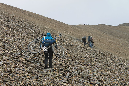
| Type of pass | Trek – carried bikes, porters took luggage |
| Where | Between Tikat (3,340m, 12km) and Sapi (3,780m, 9km) |
| GPS Co-ords | 34.308 N, 76.113 E |
| Climb | 1,800m carry/push in 1 1/2 days from Tikat |
This is a tough trekking pass to take your bike over. We hired porters to carry our equipment and took our bikes ourselves, carrying them as often as we were pushing. It was a day and a half walking up from Tikat to the Rusi La, then a couple of hours descending to Sapi. We didn’t have good weather, but have heard the views are excellent if it’s clear. We though it was worth heading this way to cycle to the nice road from Sapi to Shergol, which also means avoiding a few hours on the busy Kargil – Shergol road.