Nepal doesn’t have the best road safety record. Seemingly every day the Kathmandu Post runs stories of ‘xx dead in bus ravine plunge.’ The terrain doesn’t help. Nor do the vehicles, the majority of which appear to pre-date the Model T Ford, and are held together by bits of wire, glue and tape. Dubious driving practices only compound matters.
Now Bolivia’s North Yungas Road has lost most of its danger, let us put forward our nominee to take its dubious mantle as WMDR: west Nepal’s Karnali Highway. Of the many roads we’ve travelled by bike and bus, this stands out high above all others. A surface so bad that the tractor is the motor of choice; narrow stretches; crazy gradients; landslides; potholes that could swallow a yak; huge drops to the river below. Drivers who look far too young. Where are the old-timers? Have none managed to survive to 30, or even 20? Or do family men simply not regard driving the route day in, day out as worth the risk?
And were the stories we were told true? Had the police really banned driving at night due to the sheer number of fatal accidents? Had a bus really fallen off near Manma the month before, killing all on board? Who knows, though we spotted enough wrecks on the road (and far below it) to suggest that its deadly reputation isn’t entirely undeserved.
Thrill-seekers: if a ludicrously bumpy, uncomfortable and at times downright scary 18 hour trip to Jumla sounds like your idea of fun, make your way to Surkhet’s dusty bus station, the starting point for a rollercoaster journey.
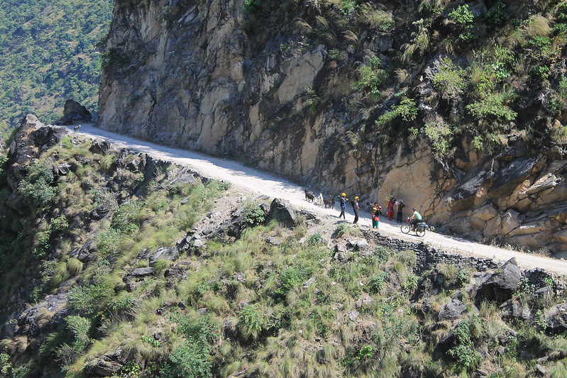
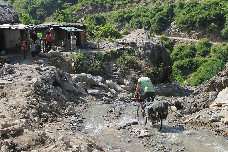
Meeting on the Karnali Highway. The drop off to the river may not be nearly as high as in the Yungas, but it’s still far enough to hurt.
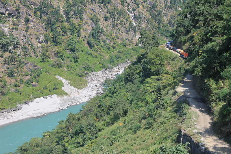
Karnali Highway traffic jam. It took these few vehicles quite a while to work out a way past one another. Most of the road is single file only.
A steep section. Too steep to cycle, but the buses can just about struggle up it.
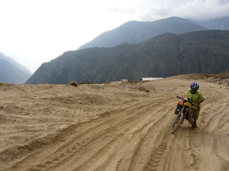
A dusty, sandy section. No chance of cycling, and vehicles slide all over the place.
Descending from Manma. More rubbish surface.
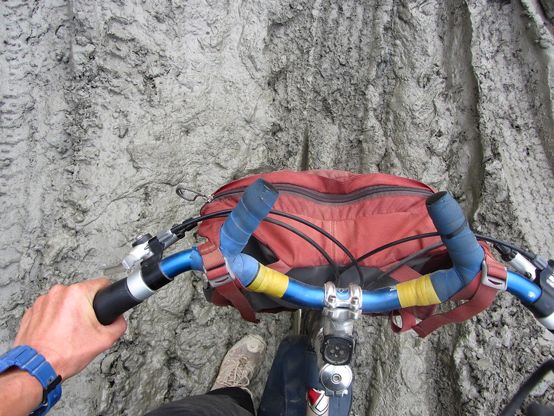
A muddy section.
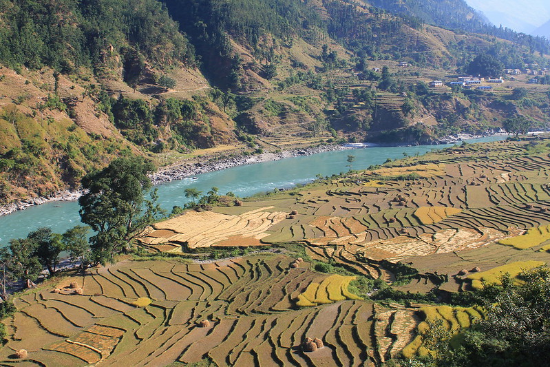
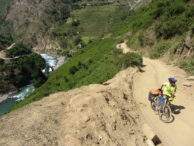
The scenery’s good though.
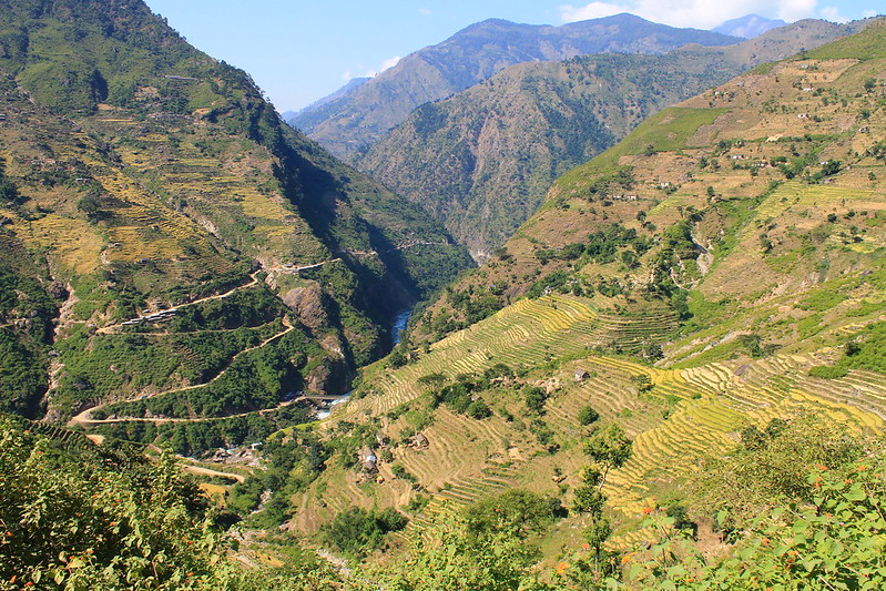
More greenery and zigzags.
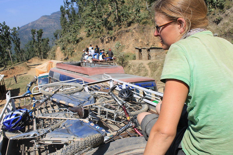
Riding the road by bus. Make sure you hold on with both hands and duck the low lying tree branches!
Love the fresh new website look! The photos really pop in this format.
Hey,
Great to see your blog about your biking trip to Jumla………….When did you go there? We (a group of MTB from Kathmandu, Nepal) are alos planning for a trip to Jumla and beyond to Rara Lake………heard they got road till the lake….. Just wanted to check with you how the road is and would it be possible to ride from Surkhet to Jumla…
thanks
Ajaya
Hi Ajaya,
Thanks for the comment! We were on the Karnali Highway in October 2012 and only cycled as far as Manma. From there we travelled to Pokhara, dumped our bikes, returned to Manma by bus and walked to Jumla!
On loaded bikes some parts of the road were really tough (and we found it very tiring being chased by kids all the way!). We had to push quite a few kms of the climb to Manma because it’s steep and the surface, as you can see in the pics, is rubbish. On an unloaded MTB I think Surkhet – Jumla would be just about all rideable if you’re fit. The first section out of Surkhet is paved, then there were muddy and rocky sections on the way to the climb to Manma. After Manma the road remains challenging with a bad surface and steep gradients for about 30kms before becoming easy for the last 50-60km to Jumla.
I didn’t realize there was a road to Rara! Have fun and let us know how the trip goes!
suerte
Neil
Delightful photos. I was searching to refresh my memory of one of my expeditions investigating animal exploitation that I made in 1994. Having arrived in Kathmandu then left my Land Rover at Trisuli Bazaar where at that time what passed for a muddy road ended. There I hired four Sherpas to carry tents, food, reels of film and equipment (all of which had been smuggled past boarders wrapped in sleeping bags on the route from England) while I carried four still cameras and a 16mm movie camera. My mission was to investigate the illegal trapping of the rare and protected musk deer. In my time the route to Tippling was along rough tracks, river crossing was by a crude seat suspended on a wire rope and pulled to the other side by a single rope. Due to the sensitive political boarder with China the only map I could obtain was a hand drawn effort that had been roneoed (early type of printing) and we eventually discovered that our destination, a tiny dot on the sketched map had been placed the wrong side of a steep valley. Alas, with the passing of time one’s memory fades with advancing years. Then we did not have digital cameras, mobile phones or GPS navigation. Communication with the UK was by teletype from a local press office in Kathmandu. International phone lines just did not work. Crossing Iran was peaceful in the time of the Sha. Afghanistan was always dangerous due to tribal infighting. But that was nothing compared while returning from another expedition in 1979 when Afghanistan was closed due to the war with Russia, and the Ayatollah had taken over Iran and we were escorted out of Tehran, by young men with a machine gun mounted on a jeep. How the world has changed!
P.S. An amusing video of a boarder crossing that I remember well: http://www.wimp.com/indiapakistan